Places to Visit in Netarhat

Netarhat Highlight :-
Historical Monuments - Viceregal LodgeChrist Church, Gaiety Heritage Cultural Complex
Natural Wonders - Chadwick Falls, Green Valley, Summer Hill
Hidden Gems - Annandale Meadow & Army Heritage Museum, Himachal State Museum, Craignano
Religious Sites - Jakhu Temple, Kali Bari Temple, Tara Devi Temple
Betla National Park
Coordinates: 23°52′N 84°11′E
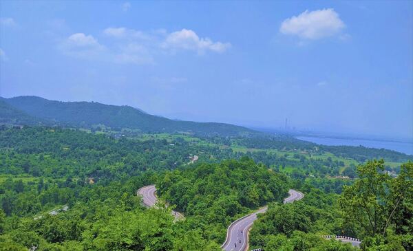
Betla National Park is a stunning national park located west of Ranchi in Jharkhand, amidst the hilly landscape of the picturesque Palamau district. The beauty and fauna alone will captivate any tourist, and wild elephants roam freely through the forest's thickets. A trip to this historic region of Jharkhand is worthwhile even though there are comparatively fewer tigers here because it offers a greater understanding of the state's unique tribal heritage. Bison, Elephant, Tiger, Leopard, and Axis are the letters that make up the acronym Betla. The existence of two forts within the park's boundaries sets it apart from the others. The main draw here is the opportunity to get up close and personal with nature. One of the most well-known national parks in the Northeast, the park has an area of about 979 square kilometers, of which 232 square kilometers make up the major area. It is also one of the first nine tiger reserves to be created in India. The Betla National Park is home to a vast array of species because of its diverse habitat. The park is home to lush bamboo and sal trees. While Bel Aegle marmelos predominate in the northern portion of the forest reserve, sal trees dominate the southern side of the forest. Small hills like the Netarhat, Huluk, Murhu, and Gulgul delineate the park's sloping topography.The park is a fascinating site to explore because it has a number of waterfalls and hot springs.
Upper Ghaghri Waterfalls
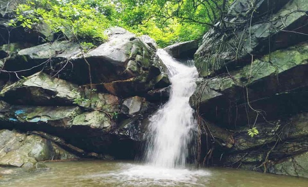
Under an overcast sky, in the middle of a verdant valley, with a gentle breeze caressing your face and twirling your hair, a thick stream of water falls noisily on the rocks from the cliff above.On a typical day, the higher Ghaghri Waterfalls, which are 4 km from Netarhat, appear like this.
Lower Ghaghri Waterfalls
Coordinates: 23°31′54″N 84°14′45″E
Inside a dense forest, there is a waterfall that rises up to 32 feet. As the water strikes the base, it pours out of the center of the jungle like a tiny river.You could only see the shadows of the dancing trees because the trees on each side of the body of water were standing rigidly, preventing the sun from kissing the water's surface.That is how lovely it appears.The distance between Netarhat and Lower Ghaghri is about 10 kilometers.

Magnolia Point
Come see the sunset; it is breathtaking! By painting itself crimson and orange, the sky says farewell to the sinking sun as it approaches six of the clock and the sun is prepared to pack for the day.If you pay great attention, you can see how the sun changes over time, from beaming brightly in the sky to gently descending and searching for a hiding place behind the powerful Vindhya mountains. Complete joy!
Pine forest, Netarhat
Hike through the pine forest and relish the experience as you become acquainted with the natural world, which will accompany you on your trip. Compared to the rest of the city, this area is marginally more pleasant and generally colder. Up until recently, it served as the governor's permanent summer station.

Best places to visit in India – Places to visit in Dooars, Places to visit in East Sikkim, Places to visit in Dalhousie, Best places to visit in Manali, Tourist places in Tirthan valley, Best hill station in uttarakhand, Places to visit in Mussoorie, Places to visit Nainital, Uttarakhand, Best Places to Visit in Assam, Arunachal Pradesh - Best Places to Visit, Darjeeling tourist places, Places to Visit in Kurseong, Places to Visit in Kashmir, Places to visit in Kolkata, & Places to visit in Pelling etc.
Best destinations to visit in India - Tawang, Namchi, Shillong, Andaman, Patnitop, Kashmir, Pangong Lake Ladakh, Nainital Lake city, Haridwar, & Leh Manali Highway etc.
Best time & season to visit in India - Places to visit in East Sikkim, Best Time to Visit Shimla, Best time to visit Manali Himachal Pradesh India, Best Time and Season to Visit Kinnaur Kalpa Sangla Chitkul, best time to visit Lahaul Spiti Valley, Best time and season to visit Nainital, Best time and season to visit Uttarakhand, Best time to visit Shillong Meghalaya, Best Time to Visit Andaman Nicobar Island, Best time to visit Arunachal Pradesh, Best Season To Visit Darjeeling, Best time to visit Kerala, Best Season to Visit Leh Ladakh, & Best time to visit Sunderbans etc.
Best things to do in India - Best things to do in Sikkim, Trekking in Manali, Paragliding in Manali, River Rafting in Manali, & Adventure activities in Manali etc.
Best Time to Visit Netarhat
Netarhat is a peaceful hill station in Jharkhand, known for its forests, pleasant climate, waterfalls, and beautiful sunrise and sunset views.
October to March is generally the best time to visit Netarhat, when the weather remains cool and comfortable for sightseeing and outdoor activities.
November to February is particularly pleasant, with chilly mornings and evenings and clear skies.
March to May can also be enjoyable, especially for nature lovers, although daytime temperatures gradually increase.
The monsoon season, from June to September, brings lush greenery and attractive waterfalls, but heavy rainfall can make some roads and outdoor activities less convenient. For comfortable sightseeing, photography, and exploring the surrounding natural attractions, October to March is a suitable period.
Best Local Dining Names in Netarhat - Hotel Prabhat Vihar Restaurant, Netarhat Tourist Lodge Restaurant, Hotel Hill View Restaurant, Local Jharkhand-style eateries, Small roadside dhabas and tea stalls
Activities in Netarhat - Sunrise viewing, Sunset viewing, Waterfall sightseeing, Nature walks, Forest exploration, Photography, Bird watching, Trekking, Camping,Scenic mountain drives
Reach Netarhat by Train & Flight
By Train: Netarhat does not have its own railway station. The nearest major railway stations are Ranchi and Latehar. Ranchi Railway Station has good connectivity with major cities such as Kolkata, Delhi, Patna and other parts of India. From Ranchi, Netarhat can be reached by road using a private cab, taxi or bus. Latehar is another useful railhead and can be convenient depending on the travel route. The journey from Ranchi to Netarhat by road generally takes several hours because of the hilly and forested terrain.
By Flight: The nearest major airport is Birsa Munda Airport (Ranchi). Ranchi has regular flights connecting it with several major Indian cities. From Ranchi Airport, travellers can hire a private cab or take road transport towards Netarhat. The road journey takes approximately 4–5 hours, depending on traffic, weather and road conditions. Combining a flight to Ranchi with a road journey is generally the most convenient option for travellers coming from distant cities.
Related Packages